Basic HTML Version


Iowa’s County Conservation System
39
ACREAGE
CAMPSITES:
E
lectric/
F
ull Hookup/
N
on-Electric
Eq
uestrian/
Y
outh/
D
ump Station/
W
iFi
WATER:
D
rinking/
S
howers
TOILETS:
F
lush/
V
ault
CABIN RENTAL:
S
easonal/
Y
ear Round
SHELTER:
E
nclosed/
O
pen/
F
ree/
R
ental
P
ICNICKING
TRAILS:
B
ike-Hard Surface/
L
imestone/
M
t.Bike/
W
ater
E
questrian/
H
iking/
S
nowmobile/
X
C Ski-
G
roomed
SWIMMING:
B
each/
P
ool
FISHING:
J
etty/
P
ier/
L
ake(acres)/
S
tream or River/
T
rout
BOATING:
C
anoe/
E
lectric/
M
otor/
BR
-Boat Rental/
R
amp
SPORTS:
A
rchery/
B
aseball/
D
isk Golf/
G
olf/
H
orseshoe
I
ce Skating/
P
layground/
S
hooting Range/
Sl
edding
T
ennis/
W
inter Sports
SITES:
A
mphitheater/
Ar
boretum/
B
ird Watching
Wildlife
E
xhibit/
H
istoric Site/
N
ature Center
P
rairie/
W
etland/
Wo
odland
HUNTING:
F
orest/
U
pland/
W
etland
County
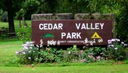
Cedar Valley Park
One of our most popular
campgrounds, Cedar Valley is
located along the Cedar
River and provides plenty of
shaded spots.
NOTE: Hunting is NOT allowed in Cedar Valley Park. The hunting area is located to the north of the Cedar Valley Road Bridge. There
is a 40 acre public hunting area upriver from Cedar Valley Park and reached by hiking the Anliker Trail that runs parallel with the river.
ACREAGE
CAMPSITES: lectric/ on-Electric/ ull Hookup,
E
N
F
outh, ump Station/ iFi, uestrian
Y
D
W Eq
WATER: ri king/ howers
D
S
TOILETS: lush/ ault
F
V
CABIN RENTAL: easonal/ ear Round
S
Y
SHELTER: nclosed/ pen/ ental/ ree
E
O
R
F
ICNICKING
P
TRAILS: iking/ questrian/ ike-Hard Surface/ t.Bike
H
E
B
M
/Bike- imestone/ nowmobile/ C Ski- roomed/ ater
L
S
X
G
W
SWIMMING: each/ ool
B
P
FISHING: ier/ etty/ ake(acres)/ tream or River
P
J
L
S
BOATING: otor/ anoe/ lectric/ -Boat Rental/ amp
M
C
E
BR
R
SPORTS: rchery/ aseball/ olf/ inter Sports/
A
B
G W
layground/ hooting Range/ orsesh e enni /
P
S
H
T
ce Skating/ edding/ isc Golf
I
Sl
D
SITES: ature Center/ istoric Site/ rairie/
N
H
P
Wildlife xhibit/ etland A a/ mphitheater
E
W
A
ird Watching/ odland boretum
B
Wo
Ar
HUNTING: etland/ orest/ pland
W
F
U
1. Bennett Park
2 mi. E of Bennett
75 E15,
N10
D V
EFY,
OFY
P H1-2
L3
W, P
P20, B,
Wo, Ar
2. Cedar Bluff River Access
11 mi. W of Tipton
17
P
S
M, C,
R
Wo
3. Cedar Bluff Wildlife Area
11 mi. W, 1 mi. N of Tipton
43
B, Wo, Ar
F
4. Cedar Valley Park
5 mi. N of Springdale
228 E20,
N15
D V
EFY,
OFY
P H2-3, X,
S1
L6, S M, C,
R
QRWH
W, P, H
A, B, Wo
F VHH
5. Hoover Nature Trail
from West Branch City Limit to
Johnson County Line
H1, 1/2,
L1, 1/2
6. Massillon Park
N edge of Massillon
20 N15
D V
EFY,
OFY
P H.5
S
M, C,
R
W, P
B, Wo
7. Mitzner Property
3 mi. SW of Tipton on Cedar Valley
Rd.
40
Wo
8. Norton Nature Area
1 mi. W of Durant
32
B, Wo, Ar
9. Pioneer Park
3 miles south of West Branch
1
D F
EFY P
10. Red Oak Park
4 mi. N, 1.5 mi. W of Tipton
7
D V
EFY P
P, H
B, Wo
11. River Valley Wetland
11 mi.W, 1 mi. N of Tipton
100
H1
S
W4, P15,
B, Wo
W,
F, U
12. Rochester Park
7 mi. S, 1 mi. W of Tipton
3
D V
EFY P
S
M, C,
R
P
13. Rock Creek Timber
6 mi. NW of Tipton
150
H2
W1, P, B,
Wo
F, U
14. Townsend Expansion
5 mi. SW of Lowden
60
P, B, Wo
F, U
15. Townsend Wildlife Area
5 mi. SW of Lowden
118
H2
B, Wo
F
16. West Rochester Sand Pit
9 mi. E of West Branch on 290th
26
L2, S
Wo
* Handicap Accessible
The Cedar County Conservation
Department has a small but
dedicated staff who work hard to
offer the citizens of Cedar County
beautiful natural areas to enjoy.
Cedar
Front quarry at Cedar Valley Park
2011 Fishing Derby at
Bennett Park
Prairie at Rock Creek Timber
Butterfly on wild bergamot